Trail Walking Hauts de Bienne - Le trou bleu Morez - Photo
© OpenStreetMap contributors
Length
Length
5.5 km
Max alt
Max alt
774 m
Uphill gradient
Uphill gradient
170 m
Km-Effort
Km-Effort  
7.5 km
Min alt
Min alt
681 m
Downhill gradient
Downhill gradient
98 m
Boucle
Boucle
No
Creation date :
2024-07-13 13:02:06.77
Updated on :
2024-07-13 14:44:29.901

(0 Reviews)

Walking
Walking
1h08
Difficulty : Medium

Scan this QR Code to open this trail in the SityTrail application

FREE GPS app for hiking

Logo SityTrail SityTrail

IGN / Geographical institutes

Download SityTrail from the App Store Download SityTrail from Google Play

Logo SityTrail SityTrail World

The world is yours!

Download SityTrail from the App Store Download SityTrail from Google Play Download SityTrail on Huawei AppGallery

About

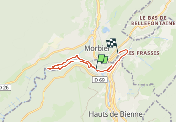
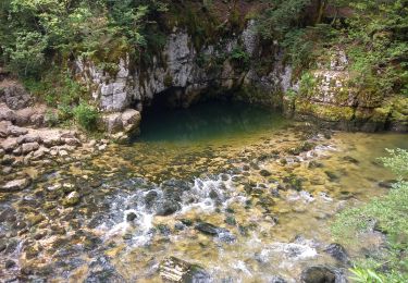
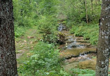
Trail Walking of 5.5 km to be discovered at Bourgogne-Franche-Comté, Jura, Hauts de Bienne. This trail is proposed by Mady Lambert.

Description

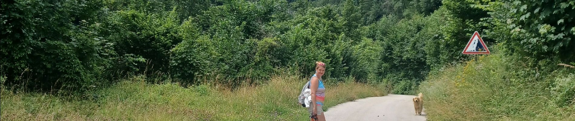
Tour le long de la Bienne, passage sur les ponts de singe, sentiers pédagogiques,  bonnes chaussures indispensables.

Elevation profile

Photos

Positioning

Country:
France
Region :
Bourgogne-Franche-Comté
Department/Province :
Jura
Municipality :
Hauts de Bienne
Location:
Morez
Start:(UTM)
271207 ; 5157381 (32T) N.

Comments

Please log in to post a review or rate the element


Randonnée incorrecte, elle ne correspond pas au tracé effectué réellement et qui faisait un peu plus de 3,5 km avec points de départ et d'arrivée identiques


Trails nearby

Trail Snowshoes Les Rousses - Lac des Rousses  - Photo
Snowshoes
nfranche

Snowshoes

Medium
(1)
Les Rousses, Bourgogne-Franche-Comté, Jura, France
13.8 km | 18.4 km-effort
4h 15min
Yes
Trail Electric bike Saint-Laurent-en-Grandvaux - 030824 - Photo
Electric bike
ricou1964

Electric bike

Medium
(1)
Saint-Laurent-en-Grandvaux, Bourgogne-Franche-Comté, Jura, France
49 km | 61 km-effort
Unknown
Yes
Trail Walking Les Rousses - lac des rousses . roche blanche . fort du risoux - Photo
Walking
GUIDE
stef789

Walking

Easy
Les Rousses, Bourgogne-Franche-Comté, Jura, France
10.2 km | 14.1 km-effort
4h 20min
Yes
Trail Walking Les Rousses - Lac
Walking
Mady Lambert

Walking

Difficult
Les Rousses, Bourgogne-Franche-Comté, Jura, France
27 km | 37 km-effort
3h 2min
No
Trail Walking Hauts de Bienne - Le Trou Bleu 11.7.23 - Photo
Walking
GUIDE
fredetpascale

Walking

Easy
Hauts de Bienne, Bourgogne-Franche-Comté, Jura, France
3.9 km | 5.3 km-effort
1h 15min
Yes
Trail Walking Bellefontaine - Pichonnier-Peraillet- village par l'Évalude - Photo
Walking
Mady Lambert

Walking

Difficult
Bellefontaine, Bourgogne-Franche-Comté, Jura, France
5.4 km | 7.5 km-effort
1h 53min
Yes
Trail Walking Bellefontaine - Des lacs de Bellefontaine vers le belvédère de la roche Bernard. - Photo
Walking
fizz1212

Walking

Difficult
Bellefontaine, Bourgogne-Franche-Comté, Jura, France
5.8 km | 8.7 km-effort
1h 53min
Yes
Trail Bicycle tourism Les Rousses - LES ROUSSES - SAINT CLAUDE  - Photo
Bicycle tourism
jean-marie.parachini

Bicycle tourism

Difficult
Les Rousses, Bourgogne-Franche-Comté, Jura, France
69 km | 88 km-effort
6h 15min
No
Trail Bicycle tourism Les Rousses - LES ROUSSES - PARCOURS EST VERS LA SUISSE  - Photo
Bicycle tourism
jean-marie.parachini

Bicycle tourism

Difficult
Les Rousses, Bourgogne-Franche-Comté, Jura, France
67 km | 85 km-effort
7h 18min
Yes


Close
My subscriptions